You are here: The Role of Drone Technology In Surveying
The Role of Drone Technology In Surveying
Surveying, whether it is land for development, construction, quantity assessment, changes to existing buildings or for ongoing building maintenance is age old and requires high levels of expertise. Technology has developed over the years with the arrival of laser ground stations, RTK/PPK satellite accuracy, rovers and other specialist equipment that have increased accuracy, removed margin of error and increased efficiencies.
Why Drones?
Drones are increasingly being adopted for a wide range of surveying tasks, with their ability to cover large areas at high accuracy, lower heights than aircraft and capability to repeat tasks with relative ease.
Drone technology has been shown to:
- Reduce costs
- Eliminate practices that carry a greater risk (e.g. working at heights, inspecting buildings that are difficult to access)
- Increase monitoring and surveying of buildings and estates due to reduced cost leading to cheaper preventative rather than more expensive reactive maintenance
- Support delivery of Net Zero including thermal imaging
Types of Drone Surveying
A drone survey also encompasses terms such as ‘building inspections’. The type of work carried out by a skilled drone team will vary depending on the level of detail, GSD accuracy and outputs required.
In short, a drone is simply another tool for a surveyor, to capture relevant data including video, images, geolocated and spatially tagged information to inform a surveying project. The drone team are part of a process and are guided by the surveyor’s brief. The majority of data capture and terminology are familiar to surveyors as the drone/s are carrying out tasks from the air that may have been traditionally carried out from the ground or at height in or on a building.
Accuracy
Using a combination of GPS and PPK/RTK with GCPs it is possible to achieve an accuracy of 15mm GSD. Whilst this level of accuracy may not be required for all drone surveys the capability is there and as opposed to traditional ground surveying techniques far less GCPs are needed which speeds up the overall process without loss of integrity of data.
The careful selection of equipment (drone, camera/s and ground-based equipment) dictate the level of accuracy that is possible.
BMI Building Inspection
Building inspections at height in particular often require scaffolding, cherry pickers or building management units (BMUs) to be utilised. However, this is not always practical or safe and can be a highly expensive exercise to carry out.
A skilled drone team can access a range of areas, capture data on vertical facades and roofs, but also enter to areas such as cooling towers, confined spaces or unstable buildings where there are high level safety risks for humans to do so.
Carried out in a matter of hours rather than weeks or days, the outputs are typically video or image based and easily identify areas for reparations or attention.
LiDAR
The uses for LiDAR (Light Detecting and Ranging) are very broad but best demonstrated through projects where sensitivity to height and light refraction are required to inform a survey project.
- Agriculture - Slope and sunlight exposure maps can be created to adjust crop management, methods and address drainage issues.
- 3D Terrain modelling – overground and underwater which has for example been used to regrow seagrass, manage rivers, flood plains, sea defences/erosion, open pit mining and quantity surveying e.g. coal heaps.
- Identifying Pollution – by measuring the particles in the air e.g. sulphur dioxide, methane, carbon dioxide and outputting the data to plan for remedial actions in urban planning.
- Building Management – creating highly accurate 3D surface models to pinpoint areas for attention and reparation or to transfer to CAD to plan development work. Sometimes used by managers of historical buildings to prioritise works for their preservation.
Orthogrammetric
Photography and ‘stitching’ together images of land or urban environments has been a technique used for over 100 years. Typically, this was carried out by planes either for civilian or military purposes.
The advantage of using a plane or indeed satellite imagery is the scale of the area that can be surveyed. However, the image resolution is often insufficient for detailed projects and the exercise is highly expensive.
Image and thermal image can be captured by a drone at much closer to ground distances and therefore higher resolution outputs created. With hybrid drones, take off vertically but then perform as a fixed wing, can cover greater distances can be surveyed at land or over sea and take off from areas where a standard plane would be unable to do so.
Thermography
Thermal imaging varies depending on the equipment used and the necessity for a high degree of detail or accuracy. For example, a thermal drone in use for search and rescue will require a less detailed output, as would a thermal check on a tower block or solar farm due to their larger surface areas. However, to finesse detail a higher grade Flir camera is required.
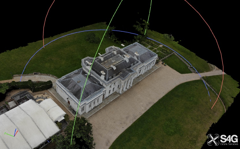
2D/3D Point Cloud Surveys
Whilst Orthogrammetric data is useful for some surveys the advent of ‘point cloud surveys’ steps up the value of drone surveying in the overall workflow. Accurately tagging images in 2D or 3D space allows for modelling and rendering of landscapes, buildings and so forth.
The output files are converted into data points that are correlated using software and then sent to architects, surveyors, quantity surveyors to import into AutoCAD. This allows for a smooth relationship between the ‘what is’ and ‘what is planned’ – repeated before, during, after a project the progress can be collated and measured.
Will drones change how traditional surveying is carried out?
In my opinion the answer is yes, but with the caveat that they will not in the short-term replace the need for highly skilled surveyors to set the parameters and interpret/use the data provided. I see the two disciplines as being symbiotic yet skilled in their own disciplines.
As with all technology there are limitations but as drones and their software continue to leap forward those gaps will close. Meanwhile, there are projects where drones are not relevant or applicable and traditional surveying is more appropriate.
In the short term, there are definitely advantages of using drones to increase competitive positioning, reduce costs and increase efficiencies within the surveying workflow. The adoption of the technology will in my view take time until awareness and confidence is more widespread. But the services are available now and skilled drone teams trained to work in collaboration with survey project teams.
Article written by Mark Elliott – Founder and Pilot, S4G Drone Services
If you are considering extending or altering your home, you may find some of these services useful:


Architectural Design Services
Find local Architectural Design experts

Find an Interior Designer
Find details of local Interior Designers

Help with Planning Permission
Find Professionals who can help you apply

Builders
Find local help with a building project
Structural Inspections
Find an expert to carry out a structural inspection

Structural Calculations
Find an expert to provide Structural Design Calculations
Building Surveys
I want a local surveyor to do a Building Survey for me