You are here: amrGeomatics (Northern) Limited - Chartered Land Surveyors
-
Company Information
 amrGeomatics provide high quality and professional land and building surveying services including:
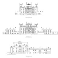
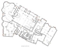
Topographical surveys and measured building surveys (delivered as 2D and 3D CAD drawings), 3D Revit building models, 3D digital terrain models, volume or area calculations, boundary investigations, sections and setting-out schedules. We always aim to provide a high quality, prompt and value for money service.
We are a team of highly qualified and experienced surveyors equipped with the latest in geomatics technology including reflectorless total stations, robotic instruments and Trimble GPS.
We operate to the highest academic and technical standards and have established a large client base with lasting working relationships by understanding every client’s individual requirements.
With our extensive experience and survey knowledge, we take pride in delivering a professional service to a wide range of clients, including Architects, Land owners, Developers, Environment Agency, Landscape designers, Rivers' Trusts, Private and Commercial Property Owners.Contact Details
Julia Robinson BA (Hons) MRICS RIBA (Affiliate) - Chartered Land Surveyor
01434 600320
07971 672071
https://amrgeomatics.co.uk/Address
1 Fore Street
Hexham
Northumberland
NE46 1ND
United KingdomServices provided - click on a service to obtain estimates and/or contact details
Boundary Disputes, Land and Topographical Surveys, Measured Building Survey
The combination of the land and building surveying knowledge results in a team that understands not only construction, but the requirements of architects, engineers and designers generally.
The in-house expertise in Revit and CAD facilitates production of the highest quality site and building drawings.
We aim to always provide a high quality, prompt and value for money service.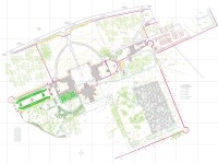
-
Feedback
Boundary Disputes, Durham, Nicola - March 2017
Promptness of response : Initial contact within 24 hours despite surveyor being on holiday.
Quality of service : Mr.Rigg is courteous, polite and explains all I need to know without waffle. He appeared when he said he would and dealt firmly but politely with the neighbour with whom I am in dispute.
Value for money : Rather pricey but I was prepared for that. Mr Rigg told me what the cost would be before I committed.
Professionalism : See above comments
Boundary Disputes, Dumfries, Josephine - October 2016Promptness of response : Prompt response & job undertaken within reasonable time frame.
Quality of service : Well documented report
Value for money : Hadn't expected the travel cost on top of quote but didn't quibble as acted promptly. Would have been better to have been aware the n advance.
Professionalism : To the best of my knowledge
Boundary Disputes, Coniston, Hilary - July 2016Value for money : Free advice given.
Boundary Disputes, Gateshead, Tyne & Wear, Mr Devenport - June 2016We contracted Mr A Rigg. He was prompt to respond. Margaret.
Boundary Disputes, Newbiggin-by-the-sea, Northumberland, D Smith - February 2021